The Walmart Effect (2006)

Summary
The history of Walmart and its economic impact.
My Thoughts
I think most people generally have a negative impression of Walmart. 'Predatory wages, lower-class shoppers, small-business killer, dystopian megacorp.' I admit this was my impression of the store as well, especially after working there one summer during college. This book doesn't necessarily pick a side but I think it opened my eyes to some of the benefits Walmart provides, namely lower-priced goods so people can afford other things and jobs for areas that may not have many employment opportunities. The book also describes Walmart as a tightly-run ship that minimizes corporate waste (a far cry from the RJR Nabisco story). Overall the book challenges the reader to weigh their desire for cheaper goods with the hidden costs they bring.
Map
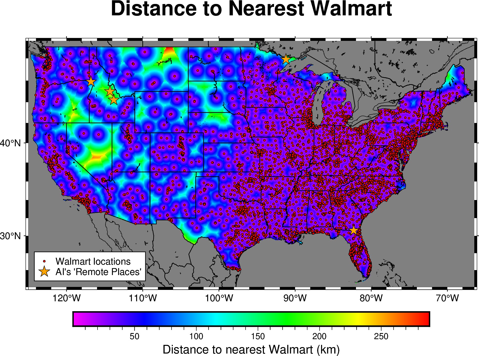
How many Walmarts are there? The dataset I found it a bit dated (2018), but contained 4654 stores (which includes Alaska, Hawaii, and Puerto Rico which aren't in the map). I wondered what place in the lower 48 states is the furthest from a Walmart. There appears to be some sort of gridding artifact happening in the northern Montana area. I'm not sure it's legitimate. I think the orange-colored area in Nevada is likely the the furthest from any Walmart. I also asked ChatGPT what it would say the most remote places are in the contiguous USA, and it gave me the 5 locations marked with orange stars on the map. I can understand all but the Florida one. No idea what it was thinking there.
Coding Notes
Walmart store data used in the map comes from a wesbite called Kaggle. This one was definitely a challenge and involved quite a bit of pre-processing. Creating a custom grid from scratch involved a lot of NumPy functions I hadn't used before (meshgrid, ravel, etc). The nearest-neighbor query (cKDTree) from scipy.spatial was really cool and I'll probably use it more in the future. This was my first time creating a mask with a shapefile which is also extremely useful when you want to ignore certain regions (in this case, everything outside the contiguous US).