The Fountains of Paradise (1979)

Summary
Earth takes on the task of building a space elevator to transport people and supplies into space without using rockets.
My Thoughts
This book was, to some extent, a love letter to the country of Sri Lanka where Arthur Clarke lived most of his life, partially to puruse a scuba diving hobby. I can't remember the exact reason, but in the story Sri Lanka has some geographic anomaly that makes it the best location to build the elevator, and they decide to build it on top of a sacred mountain. A fair amount of the story deals with tensions between the governments and the native monks who live on the mountain. There are also several flashbacks to more ancient times between warring Sri Lankan tribes. Like other Clarke books this one has a lot of technical descriptions, especially regarding the engineering of the elevator. The finale is suspenseful, similar to A Fall of Moondust. Overall I think it fell a little flat and probably sits in the lower tier of Clarke books I've read so far. The story is heavily plot-driven and there aren't any particularly well fleshed-out characters.
Map
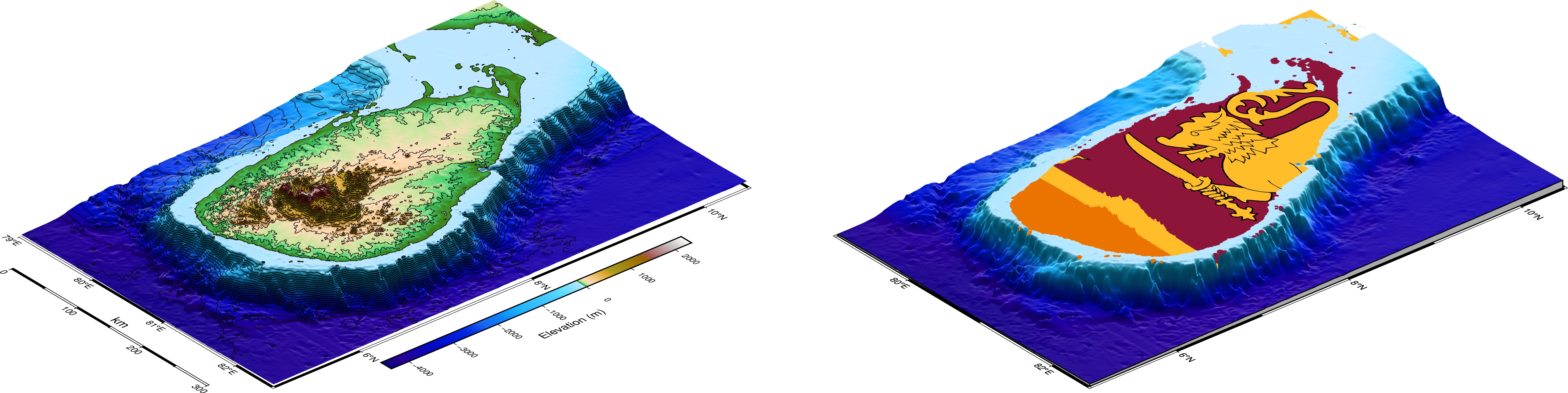
For this map I wanted to practice using the 3-D perspective abilities of PyGMT, which enables quite visually pleasing maps. Since the story is centered in Sri Lanka I decided to use the island as the focus. I also wanted to try overlaying an image onto a map and thought putting the Sri Lankan flag on the island would look neat.
Coding Notes
Data used in the maps come from PyGMT's built in earth relief dataset, and a .png image of the Sri Lankan flag I downloaded legally. The 3-D perspective is created using the .grdview method of the Figure class. Unique to this method are the 'perspective' and 'surftype' parameters which dictate the angle you view the figure from and the way the surface is mapped. I used rasterio to convert the .png image of the flag into an Xarray DataArray so it is usable by PyGMT. The second figure actually plots a surface twice: first the flag, then an elevation grid on top of it that omits the elevation values above zero so that the flag peeks through the hole. I wonder if there was a better way to do this. Ideally the flag would be smaller and more 'fitted' to the country area (the flag is actually much larger) but that would involve somehow centering the image only on the island area and not the entire map.